
The latest Digimap addition is aerial photo images, covering the whole of Great Britain to 25cm precision. The University of Edinburgh has just subscribed to Aerial Digimap, so the great news is that staff and students can now access these wonderful images, overlay them onto other map layers, and combine them with building height and topology data to make amazing and beautiful three-dimensional maps of the whole of Britain.
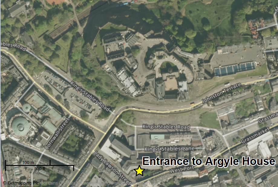
I’ve used Aerial Digimap to label the entrance to Argyle House, home of EDINA. © GetMapping and University of Edinburgh. This map contains OS data.
Digimap is a visual interface that allows users to explore, annotate and download mapping data covering the whole of Great Britain.* Digimap’s historical map data go back as far as the 1840s, while geological, marine and environmental data have been available for some time.
It’s strikingly sunny in the images of Edinburgh. The Digimap team confirmed this is a UK-wide phenomenon: “Aerial Photography can only be captured on clear days, so it’s always sunny in Aerial Roam!”
You can watch a guided tour of Aerial Digimap’s features and a demonstration of how to make the most of them by EDINA’s Ian Holmes in this recently recorded webinar:
To get started with Aerial Digimap, login with your EASE account at: http://digimap.edina.ac.uk/aerial
* For mapping data covering Northern Ireland, please see Ordnance Survey of Northern Ireland.
Pauline Ward is a Research Data Service Assistant based at EDINA, supporting staff and students at the University of Edinburgh